The Rayfin Benthic delivers on real-time inspections and surveys for ROV, AUV, drop systems, battery-powered time-lapse systems, and ocean observatories. It has many options, including video over HD-SDI or fiber optics. The Hibernation option enables timelapse photography with low-power consumption for months to a year of deployment. The Benthic is available in different models, with variants for alternative bulkhead configurations. For more information, see the Mk2 Benthic Spec Sheet.
-
Benthic SUBC39-DBH13 - Standard Subconn DBH13M Ethernet Bulkhead, Live HD video, control, and media are transferred over 10/100 and Gigabit Ethernet.
-
Benthic SUBC39-2013 - Burton 5507-2013-E004 Ethernet Bulkhead, Live HD video, control, and media are transferred over 10/100 and Gigabit Ethernet.
-
Benthic SUBC39-CREBRA11 - CRE Hybrid A BRA11 Bulkhead, Live HD video, control, and media are transferred over 10/100 and Gigabit Ethernet.
-
Benthic SUBC39-DLPBH13M - Right-angle Subconn DLPBH13M 13-pin bulkhead, Live HD video, control, and media are transferred over 10/100.
-
Benthic SUBC39-OPTOLINK - Subconn DBH13M and OPTOLINK Fiber Bulkhead, Live Ultra-High Definition 4K over Fiber optics. 10/100 and Gigabit Ethernet, HD video, and comms for uncompromised live video quality.
Block Diagram Examples
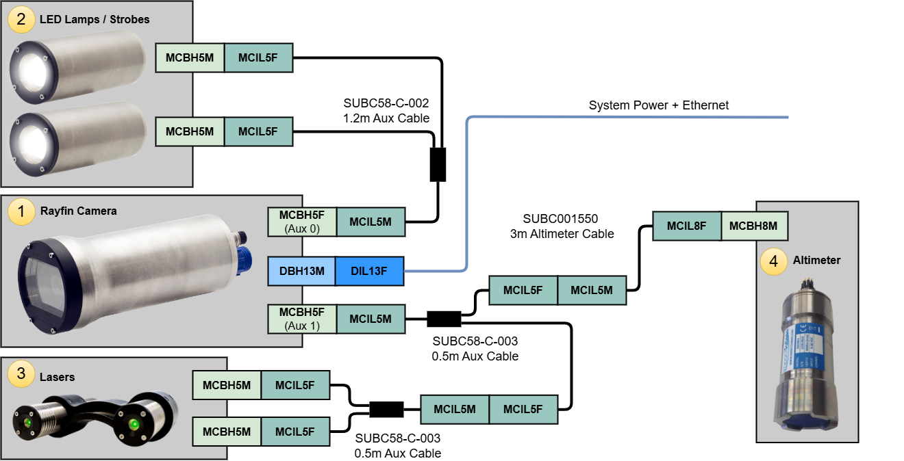
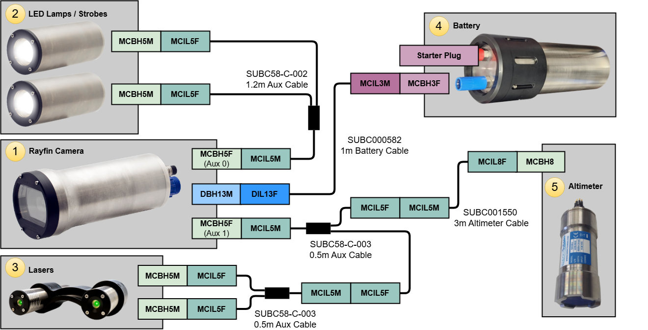
Aux Port Wiring: The diagram below represents a system where LEDs, lasers, and an altimeter are connected to the Aux ports. See Aux ports and Devices for more information.
STR SeaSpyder Upgrade with Rayfin: the below diagram represents a system where LEDs, lasers and a STR Multi-sense are connected to the Aux ports. The Rayfin is connected to the STR SeaMux I/O port.
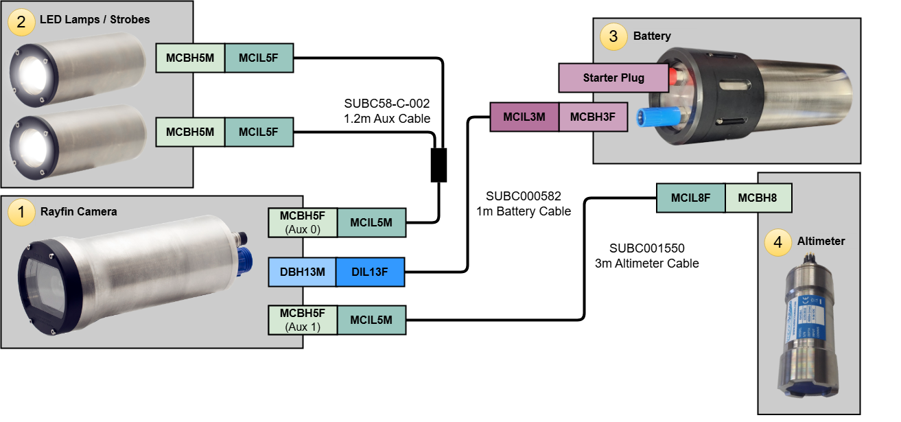
Altitude Trigger Autonomous Example: this setup adds an altitude sensor in place of the lasers. The system is then able to trigger LEDs, recording or digital stills based on the distance to seafloor.
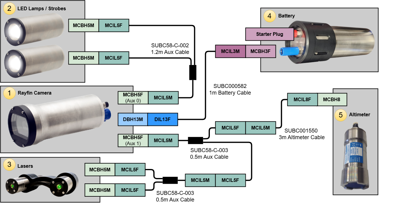
Altitude Trigger Autonomous with Lasers: this represents a system where LEDs and lasers are enabled and recording or digital stills are triggered based on the distance to seafloor from the attached altimeter.
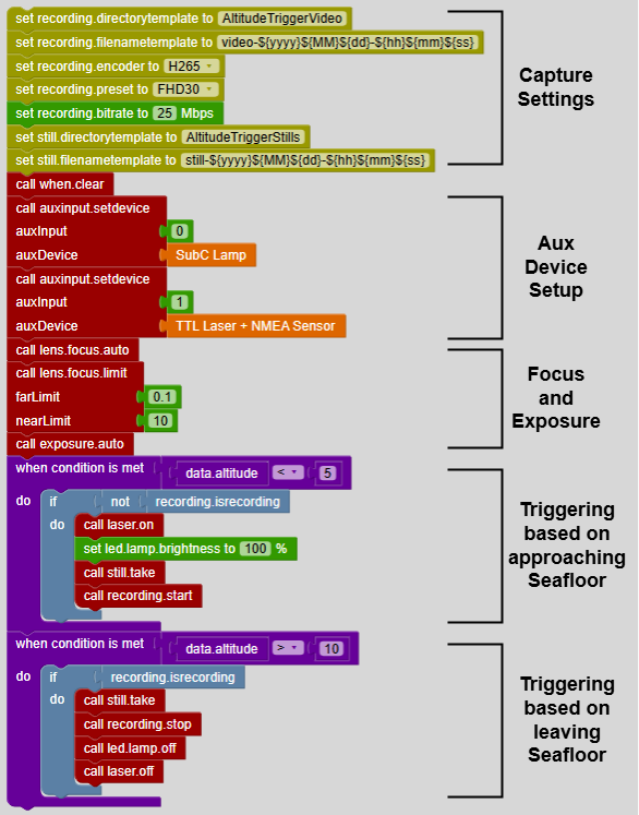
Altitude Triggered Video Recording Script
Altitude_Trigger_Recording.rsl